

In rural and agricultural insurance, understanding what’s on the ground is critical—but traditional tools often fall short. Postal addresses, rough boundary sketches, and static risk models can’t capture the complexity of farms and ranches, especially as climate risk increases and the underinsurance gap grows.
Our latest report, Precision at Scale: Embedding Geospatial Intelligence into Rural Insurance Workflows, explores how insurers are addressing several challenges in the policy lifecycle using location intelligence, and are able to use DAS directly or within existing systems, like Guidewire—the world’s largest and most robust platform for Property & Casualty (P&C) applications—enabling front line agents to utilise features such as farm boundary identification and automatic structure detection during policy creation.

What’s in the report?
Addressing the Gaps in Rural Coverage
No two farms are alike. Their size, shape, use, and exposure to climate events can vary dramatically, even across neighbouring properties. Yet, insurance processes can often rely on assumptions and incomplete data.
This report outlines how integrating geospatial tools can help insurers:
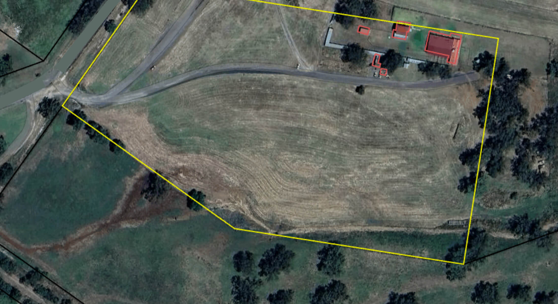
- Improve underwriting accuracy with parcel-level mapping
- Automatically detect structures
- Respond faster and more effectively to extreme weather events
- Reduce claims leakage, safely increase premiums and enhance operational inefficiencies
Practical Examples from the Field
The report includes several real-world use cases, including:
Cyclone Readiness
During Tropical Cyclone Alfred, insurers using DAS were able to overlay the cyclone’s path against their live customer portfolios days in advance. That visibility allowed teams to prioritise claims planning, notify at-risk policyholders early, and allocate resources before landfall.
Fixing Premium Leakage
A specialist insurer covering broadacre cropping used DAS to reduce exposure miscalculations. By verifying which paddocks were actually insured and identifying missing data, they improved quote accuracy and strengthened reinsurance confidence.
Bushfire Risk and Real-Time Monitoring
Read how DAS’ real-time bushfire tracking enables insurers to identify which policyholders are directly in harm’s way. This allows for faster response, simplified claims, and reduced stress for impacted customers.
Streamlining Rural Workflows
See examples of how DAS (a Guidewire partner) integrates with Guidewire. Insurers can now:
- Define farm boundaries on a map in real-time
- Auto-detect structures on a property with the ability to annotate each building with additional metadata including images, building materials and building use
- Generate geospatial insights during quoting without switching or investing in other systems
A Strategic Shift, Not Just a Tool
Geospatial intelligence is more than a layer of extra data, it enables better decisions across the entire insurance lifecycle. From initial quote to final claim, this approach gives underwriters, brokers, and claims teams the visibility they need to act with speed and confidence.
Critically, it also supports broader industry shifts:
- Meeting APRA and global climate risk disclosure requirements
- Aligning with ESG goals and sustainability-linked underwriting
- Building trust and transparency with rural customers
Learn More
This report provides a detailed look at how geospatial tools are being used in practice, not just in theory. It’s written for insurers, underwriters, and operational teams looking to adapt in a changing landscape.
Download the full report below and see how the sector is moving from assumptions to accuracy.