At DAS, we believe that mapping your customer, asset or properties should be as easy as A, B, C - a simple, modern day utility that unlocks the value of location intelligence.
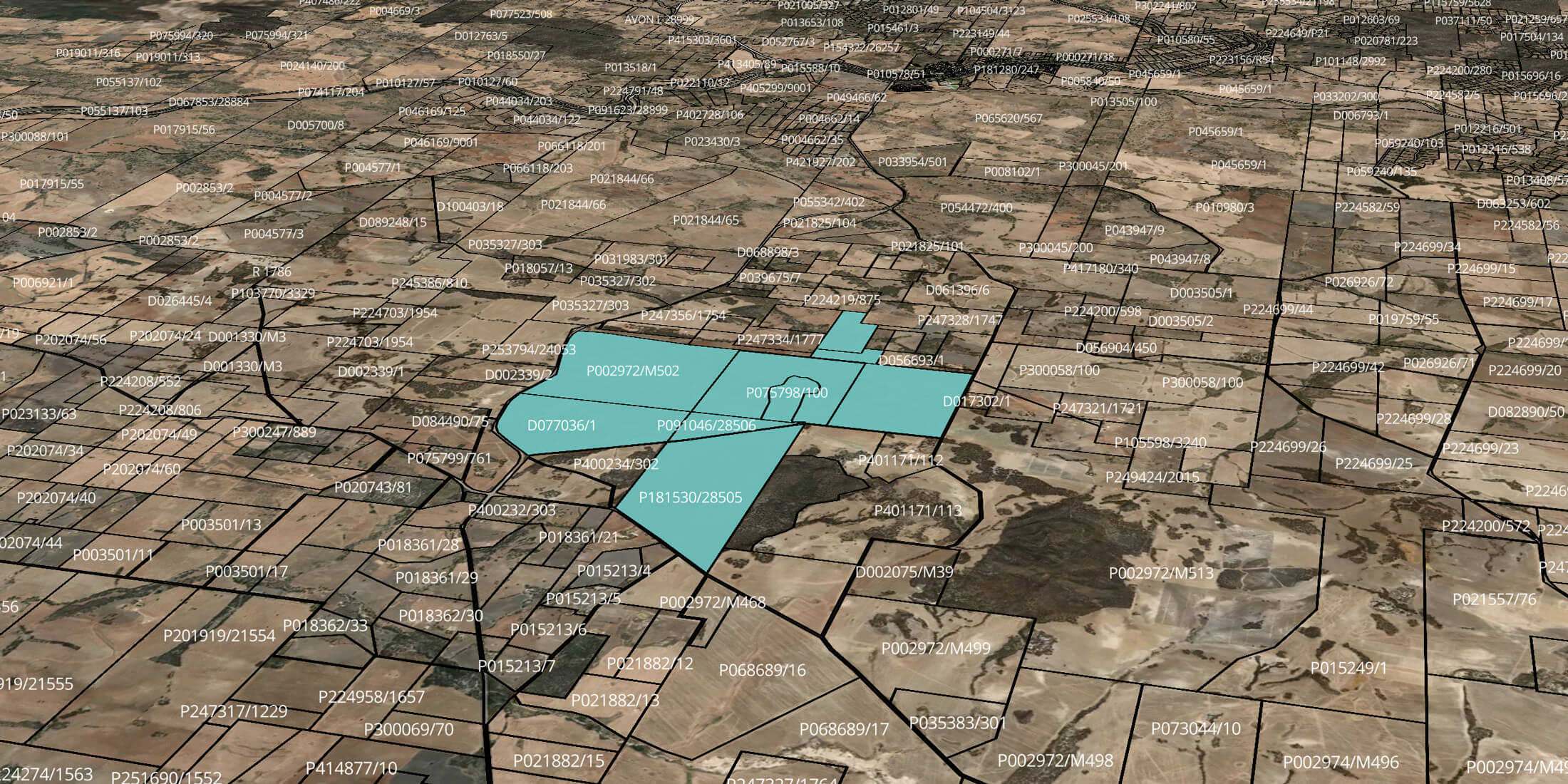
DAS Embed brings the parcel selection capabilities on the maps you see in the DAS Platform directly into your own secure systems, website or portals, giving any team, in any organisation, the power to easily identify, edit, correct and update the true geospatial area of any customer or asset in moments.
Correct digital boundary data is key for many analyses and processes, but isn’t always easy to access or update. What’s more, the usefulness of data insights that aren’t connected to a precise geographic location are limited. DAS Embed changes that, giving you simple, easy and accurate digital boundaries that you can use in combination with your own strategies and systems.
Property, parcel and field boundaries change all the time in agriculture - depending on what crop is planted, legal versus operational boundaries, leased versus owned land, and much more. And while data may be the new oil, it’s useless without accurate geospatial area and boundaries.
DAS Embed is an important tool that will simplify boundary management, which is often a huge manual effort plagued with inaccuracies.
To help understand the everyday applications of Embed, we have provided use cases spanning 11 industries that have direct input into or support the wider Agricultural industry.
Insurance
Let’s say your company is an insurance provider for farms and other Ag enterprises, or you have multiple agents or brokers out on the road meeting with grower owners to understand their needs and put together an insurance quote.
Your agent or advisor, while sitting with the potential customer, logs into the quote portal operated by your business to gather all of the information required for the quote. When they reach a point in the conversation around the total area that needs to be covered, the DAS map (via DAS Embed) is readily available in your system for the agent or broker to select the boundary-specific land parcels related to that customer - with the customer present to validate the selections.
Banking
Your company provides or facilitates loans to Ag enterprises. A current banking customer logs into their secure, online banking account (hosted by your organisation) to start a lending application.
On the application form, they are presented with a DAS Map (via DAS Embed) and are asked to select the boundary specific land areas that they wish to procure. When the application form is submitted, your team can perform valuations, risk assessments and the potential portfolio value of this land to support the application - all based on total accurate area, rather than a simple pin on a map.
Government
You collect data or statistics directly from farmers or agribusiness businesses to support research, policy and programs, emergency response or recovery. By providing access to DAS Embed for all farmers and growers across the country, you can improve data quality related to farm types, reduce the paperwork burden, better facilitate customised data requests and expedite the release of official lists.
Data providers
You are a leader in specialist data streams and predictive modelling spanning nature, biodiversity, sustainability, soil carbon or climate data. Your data is a game changer in understanding the natural capital value of land - along with measuring environmental performance. The challenge you face is that it is hard to provide sophisticated analysis with very limited location data about your client’s customers or suppliers. You are working with leading financial institutions but effectively, can’t see your data or metrics applied until you have your client’s portfolio accurately mapped. This has been done to a certain percentage, but you now need your clients’ internal teams to validate the boundary mapping. Your initial focus is on rural land so you ask your clients’ teams to use Embed, which immediately logs that data against their own.
Real estate
Your agency or franchisee network is involved in marketing and selling rural property, from lifestyle through to hobby and larger agricultural properties. You want your agents to have simple tools to be able to easily validate rural property boundaries, within your own systems. You don’t always necessarily require deep agri data in addition to the boundaries. Enter Embed.
Agents can easily map the boundaries of any property they want - and have the option to press “report” with a resulting, topline digital property report instantly shared.
Grain or industry association
Your organisation represents growers, or grain growers - including the provision of an easy, streamlined register that includes all the latest business and contact details. You want to ensure you have the most up-to-date data for e-documentation, reduce administration and duplication, and ensure your data has the right geospatial foundation to take your support to the next level. You ask growers to map their properties as part of updating their details.
Lending
You are scoping some work on natural capital and emissions assessments for your Agricultural and Rural Residential portfolio. You already have point coordinates and title reference numbers but not the right title identifiers to make further analysis easy. You ask your teams to use Embed, so that those with land knowledge can rapidly validate the underlying location area, including cadastre, that then enables the right analysis at Portfolio level.
Agribusiness company
Your company works with farmers, producers, manufacturers, retailers and other organisations, providing access to a range of tools and services to help farmers thrive. You have implemented a customer portal to support your commercial and growth strategy and while the information it holds is excellent and the data valuable, there is no map or geospatial component to the customer information it holds. You make Embed broadly available to your teams as well as to your direct customers, so that when they create an account, they don’t just include their name, role or phone number - they include their precise farm boundary details.
Farming: producer and suppliers
You have a large network of farmers supporting your retailing operations. Your organisation prides itself on its close collaboration with farmers and growers, resulting in unique, premium products that you market and sell across the country and overseas. With a focus on innovation and the best service possible, you don’t just want to build a geolocated database of your farming suppliers, you also want to understand what your suppliers are growing, how much they will produce, and increasingly, quantify the impact of natural perils. You ask your suppliers to update their details via DAS Embed in your own secure customer portal, which are then automatically captured in your CRM.
Business & Agriculture advisory
You support farmers and growers with a range of services including brokerage, accounting, finance and more. You often perform activities on behalf of your client, from business to insurance to advisory across a range of diverse areas. Your clients include SMEs and family businesses in agri, along with individuals and government agencies. You use Embed to add accurate maps on your clients’ farming and rural operations, supporting recommendations, applications and other services you provide to your clients.
Brokers
You have just rolled out a platform enabling your network of brokers to apply to multiple lending or insurance institutions at once - a direct submission to lenders giving you the ability to add key contextual information and support. You install Embed on this platform, enabling your brokers to easily include an entire mapped area on their applications, that are then easily and seamlessly submitted to banks or insurers. All within the same single, intuitive portal for you to help manage your customer deals. Not only does it remove complexity and manual tasks, it gives your brokers the option to hit “report” - seeing an associated report on the rural land or property they are getting quotes on, supporting high quality loan or insurance submissions.
How to get started with DAS Embed
With just a few lines of code embedded into your own system, website or portal, the crucial DAS platform capabilities required to make better decisions about rural & farming areas are made simple.
You can watch our demo and connect with our team about how Embed can supplement your strategy or systems by filling out the form below.


