


Europe's €50 billion flash drought shows how quickly conditions can turn, as a new DAS report reveals national averages hide where drought risk is really moving
Australian insurers need to measure drought with the same precision they already apply to flood, fire, storm and cyclone, according to new analysis from agri-fintech and geospatial data company DAS (Digital Agriculture Services).
Mandatory climate reporting under AASB S2 is already in effect for Group 1 entities, requiring disclosure of material physical climate risks, including the amount and percentage of assets or business activities vulnerable to those risks. DAS's new report, The $12 Billion Risk Insurers Aren't Pricing, examines drought as both an underestimated physical climate risk and a compound accelerant for fire and property damage.
It estimates that a single flash drought season could cost Australia up to $12 billion in lost economic output in 2026-27 alone. A drought lasting several years could push that figure to as much as $29 billion, with rural exports potentially falling by 13-18%.
"For insurers with rural and agricultural exposure, the question has moved beyond "Is drought a risk?" to "Where does that risk sit, how big is it, and how will it change? Europe has shown that a wet winter no longer guarantees a safe summer," Sarah Gorman, co-founder of DAS said. "When drought can form in weeks, annual reviews and drought declarations are simply too slow."
The warning comes as Europe counts the cost of this year's flash drought. The United Kingdom and Western Europe entered 2026 after a wet winter. By August, following their hottest June and July on record, around half of the EU and UK was in drought. Direct economic losses are estimated at more than €50 billion (around A$81 billion).
A flash drought differs from a conventional drought. Instead of building slowly over seasons or years, soil moisture collapses within weeks to a couple of months, driven by intense heat and low humidity as much as by a lack of rain.
Australia has seen this before. Eastern Australia's 2017-19 'Tinderbox' drought included some of the clearest flash drought episodes on record, with paddocks that were healthy in November 2017 severely drought-stressed by January 2018. ABARES is already forecasting a drier 2026-27 season.
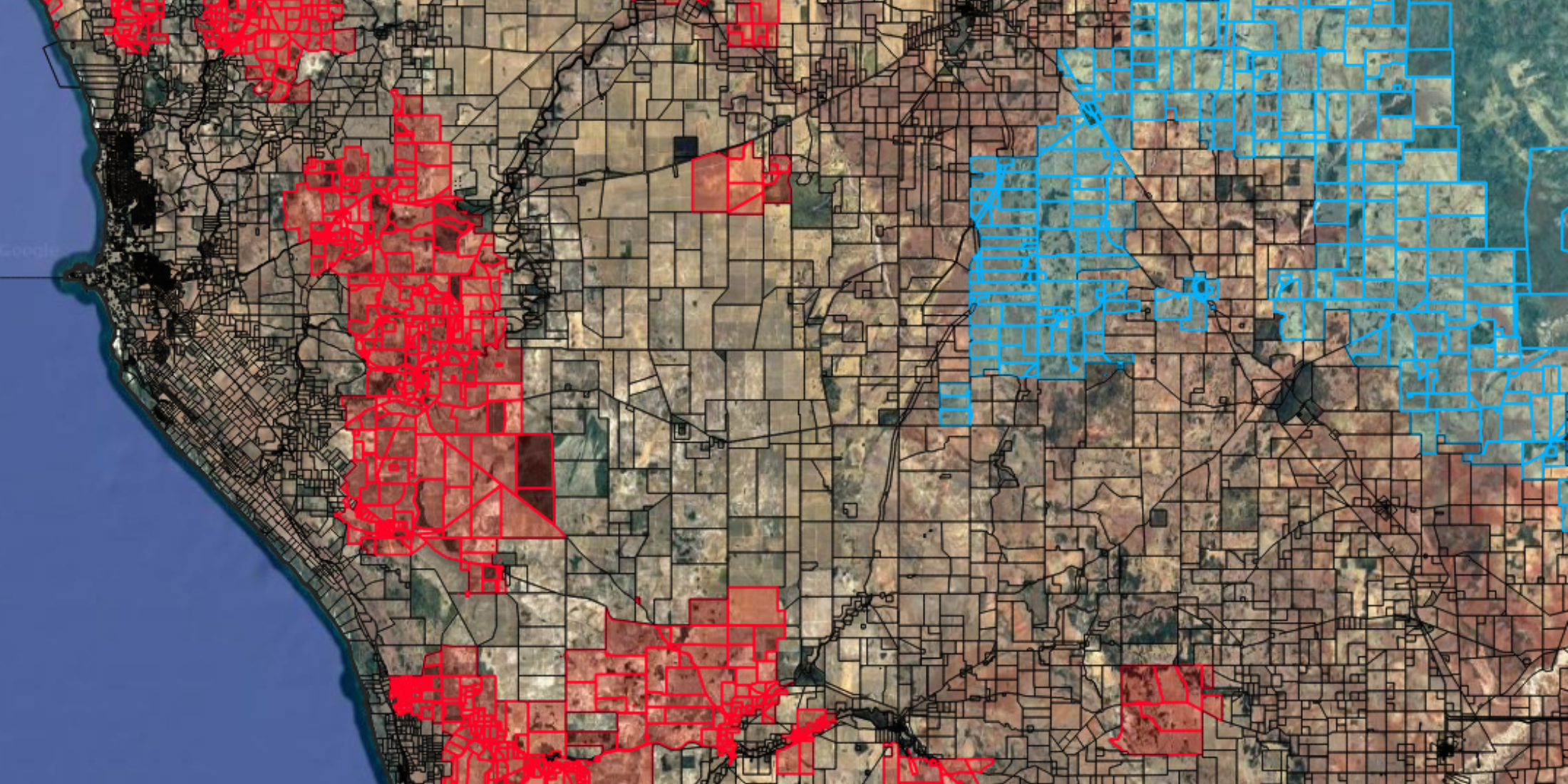
DAS has built a national drought dataset covering 3.15 million agricultural parcels, measuring drought conditions at each individual property rather than relying on national or regional averages.
The data shows more than 233,000 agricultural parcels experienced drought or drought stress in 2025. Looking ahead, 32,179 rural properties could be exposed to drought stress by 2030 under a moderate emissions scenario, rising to 89,538 by 2050.
The national average is not the risk
DAS says those national figures hide very different stories at state and local level.
In New South Wales, the share of rural properties exposed to drought stress is projected to almost double between 2030 and 2050 under a moderate emissions scenario, from 10.4% to 20.3%. Yet under a high emissions scenario, NSW exposure is lower, at 17.8%. Western Australia shows the opposite pattern, with 36.1% of properties exposed by 2050 under high emissions, compared with 14.9% under moderate emissions.
"Higher emissions don't automatically mean more drought everywhere," Ms Gorman said. "Risk can rise sharply in one region while it eases in another. Add them together and the national picture can look fairly harmless."
The differences are just as sharp at a local level. West of Geraldton in WA, two farms only 20 kilometres apart are projected to move in opposite directions by 2050, one toward more frequent drought and the other toward less. Near Narrandera in southern NSW, properties around 30 kilometres apart show the same split.
"Both of those farms could sit on the same broker's client list," Ms Gorman said. "Insurers don't write policies against the Australian average. They write them against individual properties, and that's where drought risk needs to be understood."
DAS says insurers face three blind spots with drought: visibility (where drought stress sits today), accumulation (where that stress is building across a portfolio) and trajectory (how it will change by 2030 and 2050).
Fire, flood, storms, cyclones, but a blindspot for drought
Insurers have invested heavily in understanding flood, fire, storm and cyclone risk because these perils produce clear, visible claims. Drought works differently. It builds quietly and rarely triggers a claim on its own. Instead, it shows up through other risks, including customer vulnerability, underinsurance, rising premium pressure and the severity of events that follow it.
Bushfire is the clearest example. The Black Summer fires followed severe drought across large parts of Australia and produced insured losses of $1.866 billion, the largest bushfire loss event in Australian insurance history.
"Drought may not be the claim, but it shapes the conditions around the claim," Ms Gorman said. "It's both a risk in its own right and a multiplier of the perils that follow it."
Precision as a path to staying insured
The findings come as Australia's insurance protection gap widens. APRA projects that one in four Australian households could be uninsured by 2050, up from around one in seven today, driven by rising premiums.
DAS argues better data can help slow that trend. When insurers cannot tell a high-risk property from a resilient neighbour, the typical response is to reprice an entire postcode or withdraw from a region altogether.
"Compliance may be what starts the conversation, but this is really about resilience," Ms Gorman said. "Insurers who can tell one farm from the next can stay in markets their competitors may leave. For rural insurers, drought is no longer just a farm problem. It's a portfolio risk."
About DAS:
DAS (Digital Agriculture Services) is Australia and New Zealand’s leading B2B rural property intelligence platform, transforming how businesses locate, appraise, finance, invest and insure rural assets and portfolios. DAS operates across the full rural property lifecycle, working at the intersection of AI, climate risk and geospatial tech to transform off-farm discovery, visualisation and decision-making.